
News of Madison Valley
Choose the Lake Washington Greenway Route
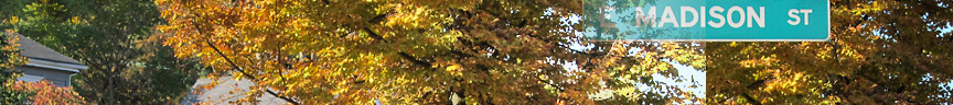
The Lake Washington Greenway organizers need your help to select which route will become the neighborhood greenway between Madison St and Boyer Ave. This is the route that will be engineered to best accommodate bicyclists and pedestrian traffic. After you finish reading the pros and cons, send your choice of route A, B or C to Lauren Squires.
If you have additional comments about car, bicycle, and pedestrian routes north of Madison St please let them know—they’d love to hear your ideas!

Remember, please send your selection to Lauren Squires.
More about the Lake Washington Greenway Route Project
Wednesday night, August 24, Madison Valley residents held a well attended meeting at Bailey-Boushay House regarding this project. Bob Edmiston of Madison Greenways and David Rodgers, a traffic engineer with MIG lead the meeting.
What is a Greenway?
A greenway is a route engineered to be bicycle and pedestrian friendly. Our previous article on greenways can be read here.
What is this project?
This project is to select, and subsequently design, the route that will be the best bicycle and pedestrian connection between East Madison St and Montlake.
What is the project timeline?

Is there funding for implementation?
No, this project does not currently have funding for implementation. The community will apply for grants for elements of implementation, and will work to encourage SDOT to incorporate the route improvements into the annual budget in future years.
How was this process funded?
Residents applied for the 2016 Park and Streets fund, and were awarded grant money to pay the traffic engineer, MIG, for their help. In addition, community volunteers have spent hundreds of hours talking with residents, mapping routes, studying future SDOT/WDOT plans, and counting cars and bikes.
The Data, So Far
To fully understand the traffic patterns in the neighborhood a study was performed this spring. The study measured vehicle speeds, volumes, route slopes, bicycle counts, and more.
Arterial Streets
This map shows the high-traffic arterial streets through the neighborhood.

Potential Greenway Routes
Again, here we see the three routes being considered as the North/South connection. I have labeled them A, B, and C for easy identification.
A = 25th Ave
B = 28th Ave connecting to 26th
C = 29th Ave connecting to 26th
Daily Vehicular Traffic
This map shows the number of cars traveling along the three potential routes each day. 28th Ave East has the most traffic, and this makes sense given the traffic light at Madison and the 28th/MLK intersection.

Vehicle Speeds
On this map we can see where cars are traveling fastest.

Daily Bicycle Traffic
The same route that carries the most cars also carries the most bikes. It’s interesting to note Route B is also the Lake Washington Loop Trail — an existing, well-known bike route.

Street Slopes
While Route A has less traffic, it also has the steepest slopes.

To learn more visit:
Project Website: www.seattle.gov/transportation/lakewashingtonloopgreenway.htm
Arboretum Neighbors for Safer Streets: https://arboretum.nextdoor.com/groups/724004/
SDOT Neighborhood Greenways Program: http://www.seattle.gov/transportation/greenways.htm
Photos from Wednesday’s Meeting


Comments?
If you have comments and ideas for this project, please share your feedback by sending email to Lauren Squires.

As a resident of the area and a regular user of these streets (by foot, bike, and car), I will start by saying how happy I am that we are having this conversation. We should always do our best to make our streets functional and safe for all the users - especially the bikers and walkers. It seems that both options B and C are good options. However, I do think that a slight modification of the potential options would bring the best of both worlds to the table. If option C continued up Roy (a block before Madison) and then turned left along the B path to Madison, it seems this would create the best possible option for pedestrians, users of the new play fields, and also the bikers who would benefit from the stoplight at Madison. This would allow for option C to fulfill its greatest benefit - that being that it only has side traffic coming from one direction as Washington Park creates the boundary on the other side, and allowing for an existing stoplight for crossing Madison. In closing, if the options are set in stone as proposed, then I feel option C is the best - especially if a traffic light were an option at Madison.